A fisher peering over a log at night
Research

Rigorous answers to questions that matter.

Seven graduate-led field projects and a set of lab-wide programmes, from Oregon's dunes and burn scars to the farmland of Brazil.

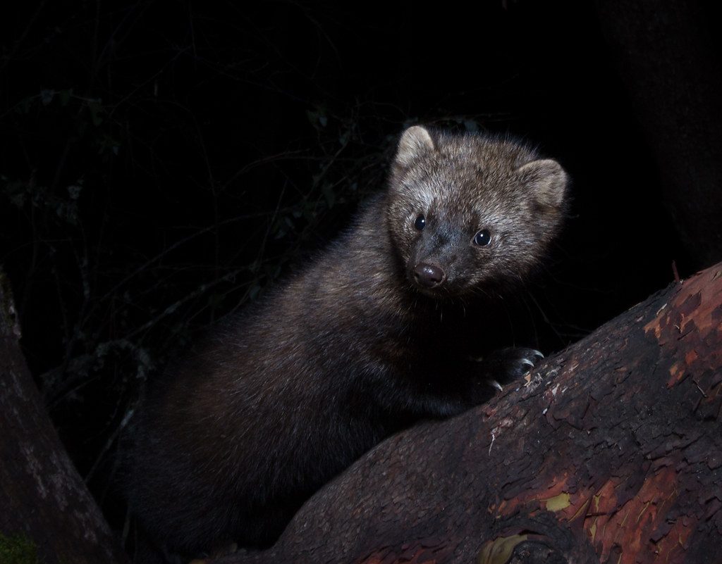
Fisher · Photo: Jonny Armstrong
Our approach

Field data and statistical models, built together.

We do not treat field ecology and quantitative ecology as separate jobs. The design of a survey decides what a model can say, and the limits of a model decide what a survey should collect. So our projects run in both directions at once: field programmes that generate the data management needs, and methodological work that asks whether the tools we all rely on are telling the truth.

Most projects are built with partners, including state and federal agencies, forest-sector scientists and Oregon's growers, and many are designed to become monitoring that outlives the grant that started it.

Theme 01

Carnivore ecology & conservation

Carnivores are rare, wide-ranging and secretive: everything that makes a population hard to estimate. They are also the species whose recovery, decline and conflict with people most often land on a manager's desk.

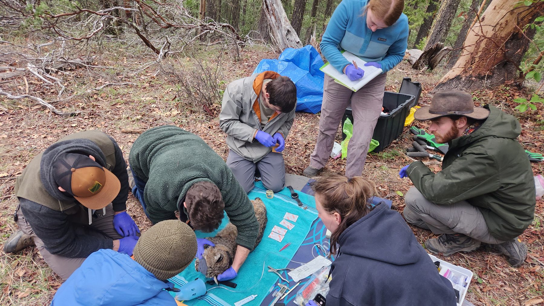
A field crew kneeling around a sedated bobcat, taking measurements and notes
Capture crew at work, southern Oregon

Cougars, bobcats and fishers in southern Oregon

Led by Jessalyn Ayars, PhD student and NSF Graduate Research Fellow, with Dr. Wes Binder

Fishers (Pekania pennanti) in southern Oregon share their forests with cougars and bobcats, larger carnivores that compete with them for prey and sometimes kill them. Whether that pressure shapes where fishers can persist, and what managers could do about it, is an open question.

Working with the Oregon Department of Fish and Wildlife, we capture cougars and bobcats each winter and fit them with GPS collars and daily diary tags, accelerometer loggers that record behaviour second by second. A grid of remote cameras, analysed with spatial mark–resight models, estimates how many carnivores share the landscape. Together with diet analysis, these data build a mechanistic picture of how the three carnivores divide up space, prey and risk.
Methods
Spatial mark–resight, GPS telemetry, daily diary (accelerometer) tags, remote cameras, diet analysis
Partners
ODFW Western Research, led by Dr. Kiefer Titus
Related papers
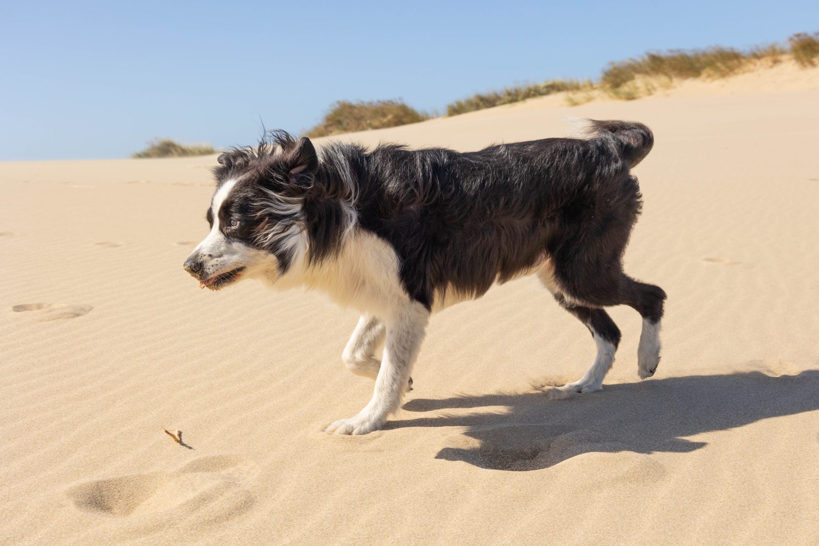
A black-and-white scent-detection dog crossing a sand dune
Detection-dog survey, Oregon Dunes

Coastal marten abundance and demographics

Led by Dax Morfin, PhD student, co-advised with Dr. Taal Levi

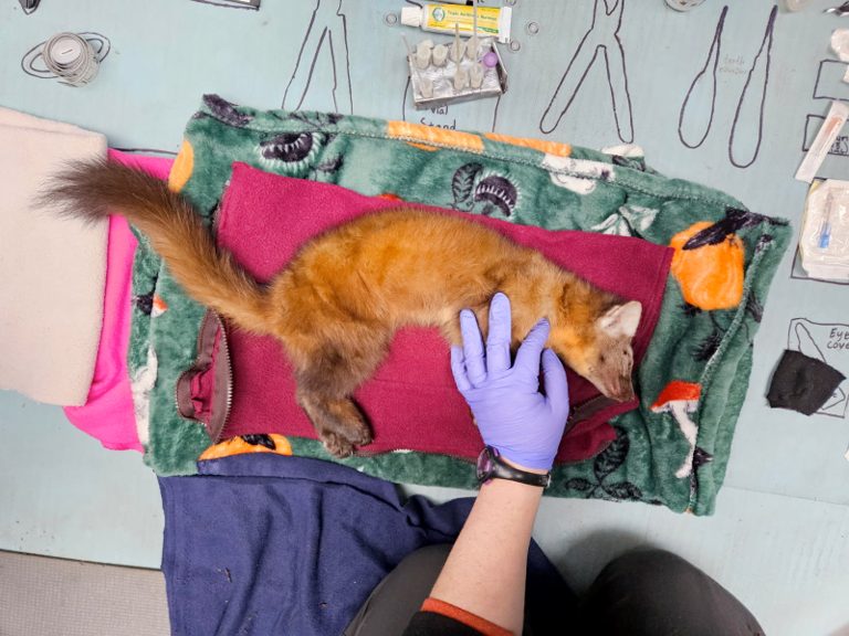
The coastal marten, the coastal population of the Pacific marten (Martes caurina) also known as the Humboldt marten, survives in a handful of small, isolated populations in coastal Oregon and northern California, and is federally listed as threatened. Recovery planning depends on numbers that are very hard to get: how many martens there are, how well they survive, and how many young join the population each year.

On the Oregon coast, including the shore-pine forests of the Oregon Dunes, scent-detection dog teams search for marten scats, and DNA from those scats identifies individual animals without anyone needing to catch one. Spatial capture–recapture models turn those genetic recaptures into estimates of density and vital rates, the quantities that tell managers whether a population is holding on.

Methods
Detection-dog surveys, non-invasive genetics, spatial capture–recapture
Co-advisor
Dr. Taal Levi, Oregon State University
Related papers
A Pacific marten, sedated for a health check, lying on a blanket under a researcher's gloved hand
Pacific marten during handling

Coastal marten density and survey design in northern California

Led by Tessa Chesonis, PhD student

Monitoring only helps a threatened species if it can detect change. Based in northern California, this project combines remote-camera surveys with GPS tracking of martens to estimate density, and then uses simulation-based power analyses to ask how many cameras, how far apart and for how long a monitoring programme needs to run to reliably detect a decline. The goal is a sampling protocol that agencies and forest managers can apply across the coastal marten's range.

Tessa also leads our test of airborne environmental DNA, sampling the air itself for traces of the mammals that live in a forest, against remote cameras in OSU's McDonald–Dunn Research Forest.

Methods
Remote cameras, GPS telemetry, simulation-based power analyses, airborne eDNA
Partners
NCASI and Dr. Katie Moriarty
Related papers
Theme 02

Small mammals & population dynamics

Small mammals are the quiet scaffolding of most food webs on land, and some of the most dynamic populations on earth. They are also surprisingly hard to monitor well at scale.

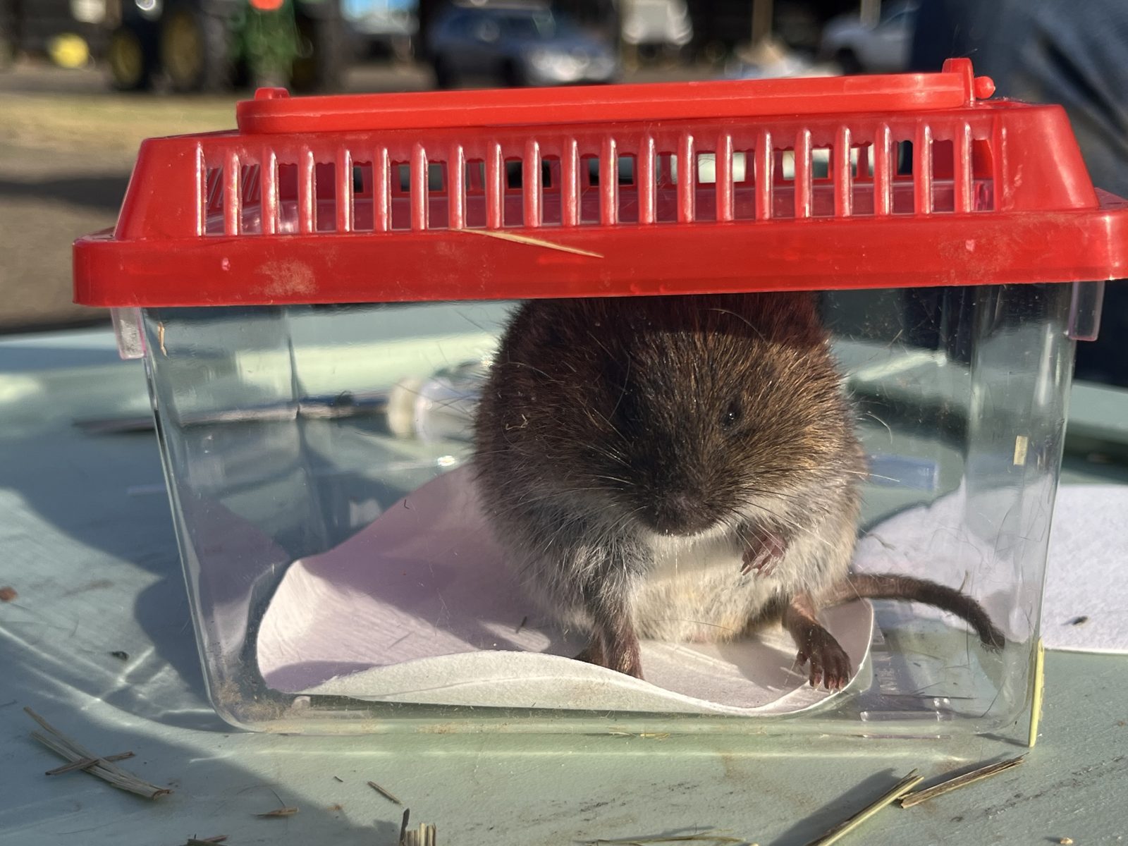
A gray-tailed vole in a clear handling tub with a red lid
Gray-tailed vole, Willamette Valley

Gray-tailed voles: population dynamics, disease and movement

Led by Austin Nash, PhD student

The gray-tailed vole (Microtus canicaudus) lives almost nowhere but the Willamette Valley, where its populations periodically erupt. In outbreak years voles strip grass-seed, clover and other crops across the valley. Between outbreaks they can be hard to find at all. Why populations boom, why they crash, and whether an outbreak can be forecast are open questions with real costs for growers and for the predators that depend on voles.

We are building long-term monitoring of vole populations, using live-trapping and open spatial capture–recapture models to follow density, survival and recruitment through the cycle. Alongside it, we screen voles for pathogens to test the role of disease, and fit miniature biologging tags to measure how voles move and behave.

Methods
Live-trapping, open spatial capture–recapture, disease monitoring, biologging
Partners
Willamette Vole Management working group and Willamette Valley growers
Find out more
oregonvoles.org
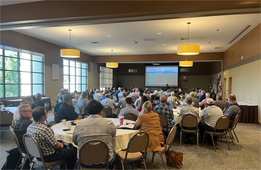
Growers and researchers seated at round tables watching a presentation at the Willamette Valley Vole Summit
Willamette Valley Vole Summit

Working with growers: the vole working group and field-scale experiments

A lab-wide, interdisciplinary programme

Managing a rodent that damages crops is as much a social problem as an ecological one. We are part of the Willamette Vole Management working group, which brings growers, researchers, agencies and non-governmental organisations together to co-develop science-based, grower-led strategies for living with voles.

With the group, we help organise the annual Willamette Valley Vole Summit, where growers and researchers compare notes and map where and when voles have hit hardest. We are also building large experimental enclosures at OSU's Hyslop Farm, where vole densities can be set and held, so that the damage a given number of voles does to a grass-seed crop can be measured directly rather than guessed.

Methods
Stakeholder working group, grower mapping, large-scale field enclosures
Partners
Willamette Vole Management, OSU Extension Service, USGS Oregon Cooperative Fish and Wildlife Research Unit, Oregon Grass Seed Commissions
Find out more
oregonvoles.org
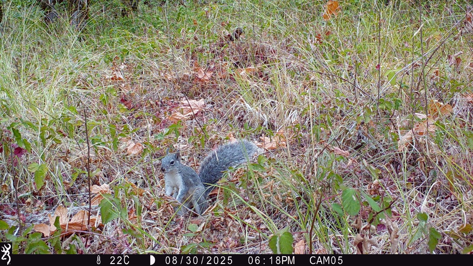
A gray squirrel photographed by a remote camera among grass and fallen leaves
Gray squirrel on a remote camera

Western gray squirrels: monitoring at landscape scale

Led by Mackenzie McCoy, PhD student

The western gray squirrel (Sciurus griseus) has declined across much of the Pacific Northwest and is state-listed in Washington, yet there is no established way to count it over large areas. We are developing one.

Hair-sampling stations collect DNA without capturing animals, individuals are identified with a purpose-built genetic marker panel, and spatial capture–recapture models convert those detections into density. Camera-based occupancy surveys extend the picture across the wider landscape, and simulation-based power analyses show how much survey effort is needed to detect future change.

Methods
Non-invasive genetics, spatial capture–recapture, remote cameras, simulation-based power analyses
Funding
Oregon Department of Fish and Wildlife; Fish and Wildlife Habitat in Managed Forests (FWHMF) Research Program
Partners
ODFW, Washington Department of Fish and Wildlife
Related papers
Theme 03

Wildlife in changing landscapes

Fire, invading species and agriculture rewrite habitat faster than most monitoring can keep up with. We study how whole communities of birds and mammals respond, and what management can do to tip the outcome.

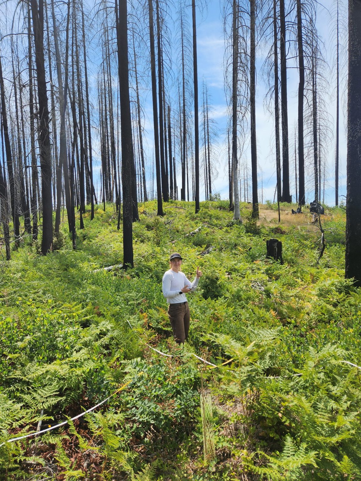
A researcher standing among burned snags and regrowing ferns
Post-fire forest near Roseburg, Oregon

Birds and mammals after wildfire

Led by Noelle Foster, PhD student and NSF Graduate Research Fellow, co-advised with Dr. Melanie Davis

Large wildfires are reshaping western Oregon's forests, and the decisions that follow a fire are often made with little information about how wildlife responds. In burn scars outside Roseburg, we survey birds with autonomous recording units and point counts, and mammals with remote cameras.

Bird data from the two methods are combined in an integrated distance-sampling framework to estimate density, and mammal detections feed multispecies occupancy models. Together they show how whole communities respond to fire and to the land management that comes after it.

Methods
Autonomous recording units, point counts, remote cameras, integrated distance sampling, multispecies occupancy models
Partners
ODFW Western Research, led by Dr. Kiefer Titus

Great horned owls and barred owls

Led by Aaron Henderson, MS student, co-advised with Dr. Damon Lesmeister

The barred owl's spread through Pacific Northwest forests is best known for its effect on the northern spotted owl. Its relationship with the rest of the owl community is much less understood.

Using a network of autonomous recording units, this project maps the distribution of the great horned owl, a widespread native predator, and uses occupancy and multi-species models to ask how great horned owls and barred owls influence where the other occurs.

Methods
Autonomous recording unit network, occupancy modelling, multi-species models
Partners
Dr. Damon Lesmeister, USDA Forest Service
Related papers

Large vertebrates in Brazil's farmed landscapes

Led by Josh Twining with collaborators in Brazil

Much of the world's remaining wildlife lives outside protected areas, in landscapes that also grow food. With collaborators in Brazil, we use camera-trap surveys and hierarchical models to estimate the occurrence and abundance of large vertebrates across multi-use production landscapes, and to test how well privately owned forest reserves on working farms sustain threatened species. The aim is evidence that can inform land-use policy.

Methods
Camera-trap surveys, occupancy and abundance models
Related papers
Theme 04

Methods for monitoring & inference

Every estimate is a model's reading of imperfect data. We spend a lot of our time asking whether that reading can be trusted, and building tools that are cheaper, more honest, or both.

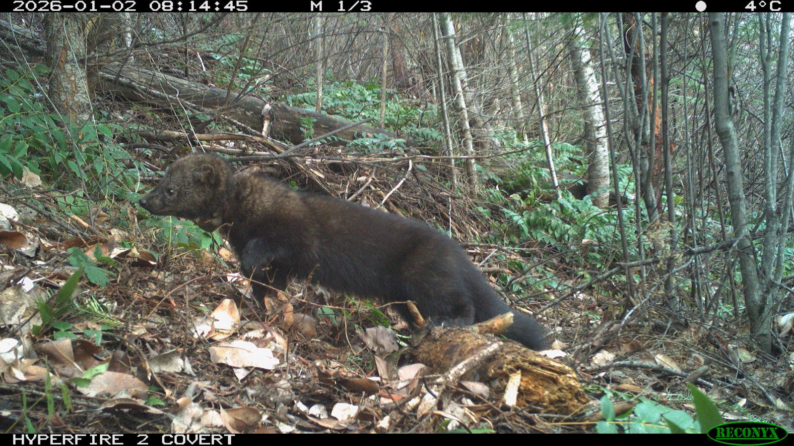
A fisher photographed by a remote camera, with the camera's time and temperature strip along the top
Every image is a data point

Hierarchical models for abundance, interactions and monitoring design

Led by Josh Twining with collaborators; a thread through every project in the lab

Much of our methodological work puts a blunt question to the models ecologists rely on: do they recover the truth when we know what the truth is? Through simulation and case studies we have shown when co-occurrence models can, and cannot, reveal interactions between species; developed abundance-mediated interaction models that let one species' numbers, not just its presence, affect another; combined opportunistic records with structured surveys for species that are difficult to monitor; and built spatially explicit power analyses for multi-species monitoring programmes.

We are currently developing hierarchical distance sampling for camera-trap data, a way to estimate the density of animals that cannot be individually recognised from how far away cameras detect them. Students in the lab meet these tools in FW 599 Applied Hierarchical Modeling and put them to work in every project above.

Methods
Occupancy, N-mixture and distance-sampling models, spatial capture–recapture, integrated models, Bayesian inference, simulation
Related papers
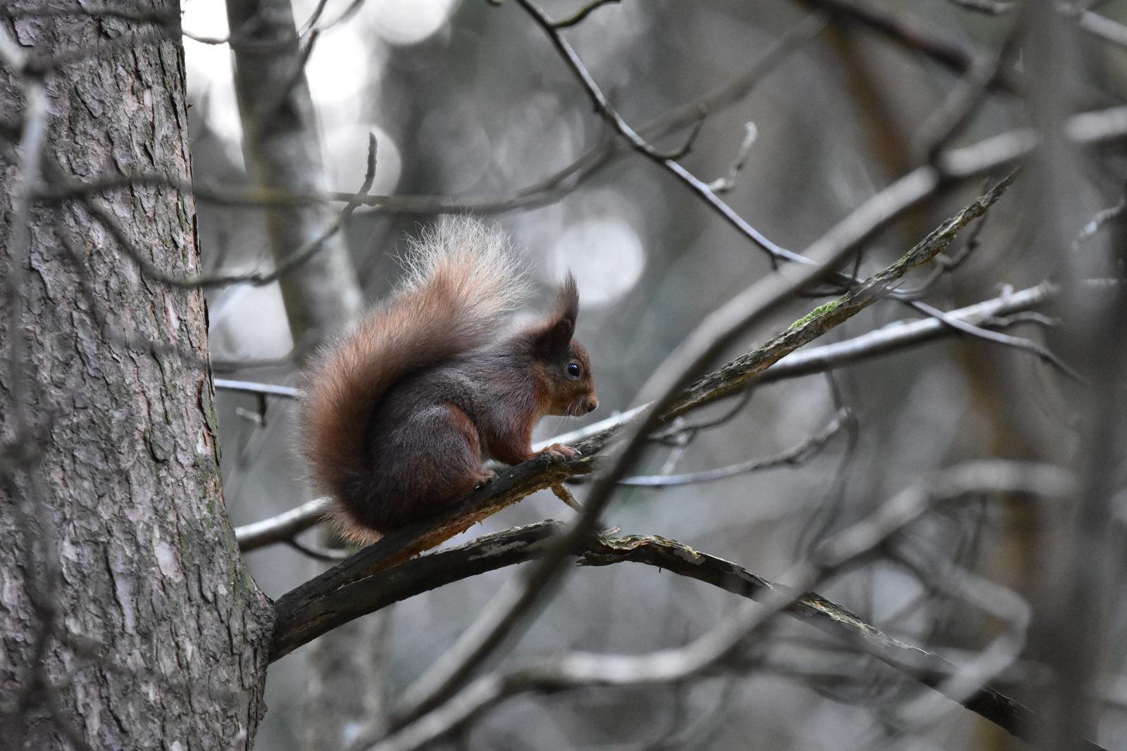
A red squirrel sitting on a bare branch
Red squirrel, Ireland · Photo: Josh Twining
Where the questions started

A native predator and two squirrels

The lab's interest in how species interactions shape populations began in Ireland. There, the recovery of a native predator, the European pine marten, is reversing the replacement of native red squirrels by invasive grey squirrels. Greys are naive to a predator they did not evolve with. Reds are not.

That work showed that restoring a predator can deliver biological control of an invasive species across whole landscapes, and that the outcome depends on habitat and evolutionary history. The same questions, about who limits whom and how we would know, now run through our work on martens, fishers, bobcats and owls in Oregon.

Key papers
Work with us

Our best work starts from a problem someone needs solved.

If you manage wildlife, land or crops and have a monitoring or management question, we would like to hear from you. The full record of our published work is on the publications page.